
Survey-Grade Drone Mapping & Geospatial Data Assistance
Empower your surveying and engineering workflows with high-precision aerial data collection and photogrammetry services across South Carolina.
We Don't Replace Surveyors.
We Empower Them.
Palmetto Drone Co. provides the "eyes in the sky" and raw data processing to shave days off traditional ground-based surveying workflows.
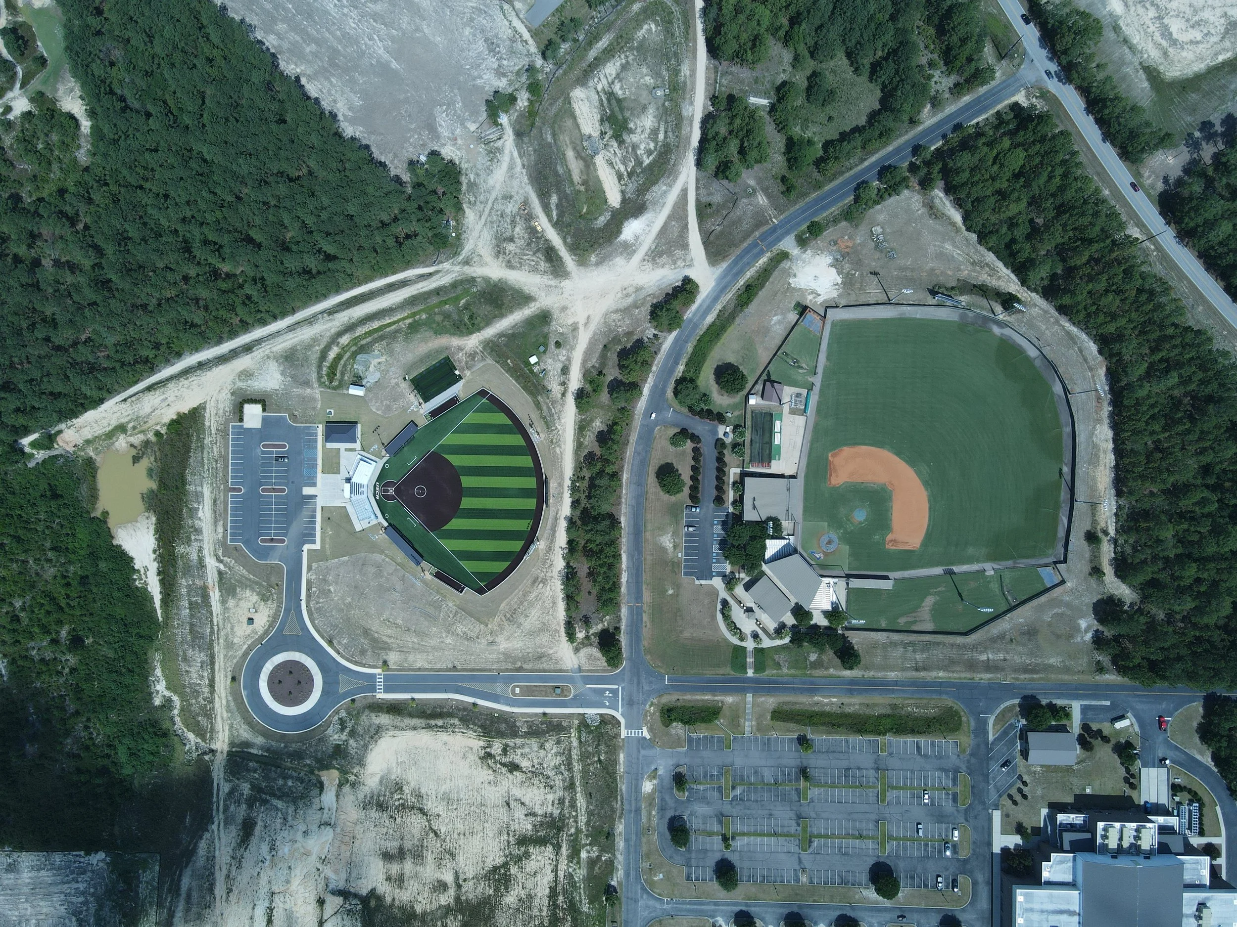
Rapid Data Acquisition: Scan hundreds of acres in a single day, significantly reducing field time.
Safe Access to Challenging Terrain: Map steep slopes, marshlands, and hazardous sites without putting crews at risk.
High-Density Data: Capture millions of data points for more detailed topographic analysis than traditional methods.
Precision Geospatial Outputs
We deliver industry-standard files compatible with Civil 3D, ArcGIS, and Bluebeam:
High-Resolution Orthomosaics: Georeferenced 2D maps for precise distance and area measurements.
3D Point Clouds & Mesh: Detailed digital reconstructions of structures and terrain for BIM and planning.
Digital Elevation Models (DEM/DSM): Accurate surface and terrain data for drainage and site grading analysis.
Topographic Contours: High-detail contour overlays generated from aerial photogrammetry.
Accuracy You Can Trust

Accuracy is our baseline. We utilize Ground Control Points (GCPs) and manual tie-point marking to ensure every dataset meets your project's specific horizontal and vertical precision requirements.
Equipment: (Optional: List your high-end mapping drone/RTK setup).
Compliance: Fully FAA Part 107 certified with specialized experience in SC airspace coordination.